Route 2000 Europe by Route 66
Software reviewed by Hans Molenaar
Introduction
The company Route 66 from the Netherlands has recently upgraded their series of routeplanners and has come up with the name Route 2000. Reviewed was Route 2000 Europe, scaled to level of large, connecting roads.
The main reason of my interest in this product was GPS Support. Where other products targeted for the Netherlands allow the user to select coordinates as method for input/output, Route 2000 actively supports a GPS receiver connected to your PC. The product allows you to plan a route on your PC and print maps and directions. When combined with a laptop and a GPS it will show you where you are.
Installation
A typical installation of Route 66 Europe leaves 200 MB of data on your harddisk, whereas a full installation -needed for quick operation- takes 500 MB away of your hard disk space. Minimum CPU is a Intel Pentium 120 MHz, advised is 300 MHz.
At home or office
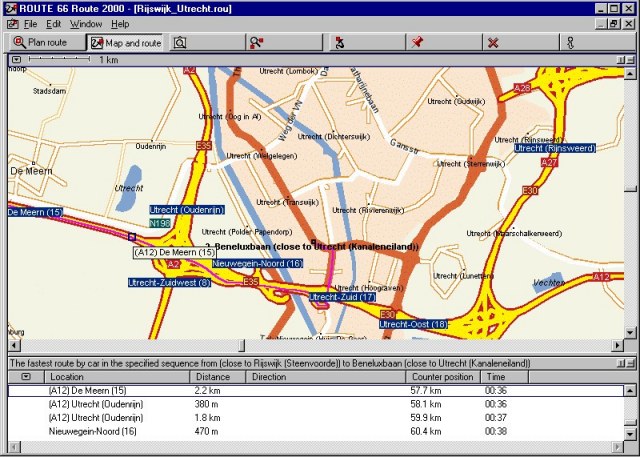
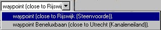
So let's start a trip by defining start and end, which is usually a city or a point of special interest. For example for from an office in Rijswijk to Compaq headoffices in Utrecht. I only had to type 'Rijswijk' and 'Utrecht' respectively and select from a dropdown list. After hitting the 'calculate' button you will be presented with a map and a list of directions.
On the road.
Afterwards I usually switch to a view whereby the screen is less cluttered, and shows map and directions only. The Garmin © GPS receiver was switched to NMEA 0183 output and hooked up with a cable through the serial port. A window shows status of the GPS with your position, speed and distance to your chosen waypoint. When asked to do so [checkbox] it also centers the screen automatically, thus showing you on the map where you are.
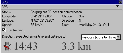
When moving, a red cross changes into a red/black arrow showing you the way to go. It has the same function as the arrow found on the screen of your GPS, thus only showing your direction 'as the crow flies'. Also, the directions given are connected to the map shown
Points of Interest
The following points-of-interest are in this package, unfortunately no petrol-station are among them:
Map details
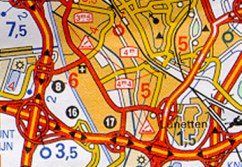
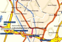
Whereas the maps in the county-series of the Route 66 series usually are scaled to street-level, you can expect for Europe one lesser step of detail. It means that large roads are shown, so that navigating through a city can be done as long as you stay on the connecting roads. The details are comparable to paper maps with scale 1:200.000 see for example a scan from the Michelin map 211 "Nederland"
|
|
|
|
Michelin map 211 "Nederland" |
Route 66 Europe 2000 |
No can do.
Conclusion.
Like other software programs, Route 66 can automatically calculate the quickest or shortest route to your destination. You can add multiple intermediate points. Destinations can be in the form of adresses os points-of-interest. Route 66 is among the first to incorporate GPS support among its range of products. When connected to such a device, it shows you where you are. Other use, as in uploading routes or maps is not provided.
The requirements for these products in the case of MS-Windows are:
Minimum: 486 processor 120 MHz, 32 MB RAM, 70 MB hard disk space; CD-Rom drive.
Recommended: Pentium 300 MHz processor, 64 MB RAM, 480 MB hard disk space, 8X CD-Rom
According to the copyright screens, Geographical Information is supplied by AND Data Solutions bv
Hans Molenaar: Hans_Molenaar@Hotmail.com (review was done on personal basis)